


Ethan Jones
Staff Writer
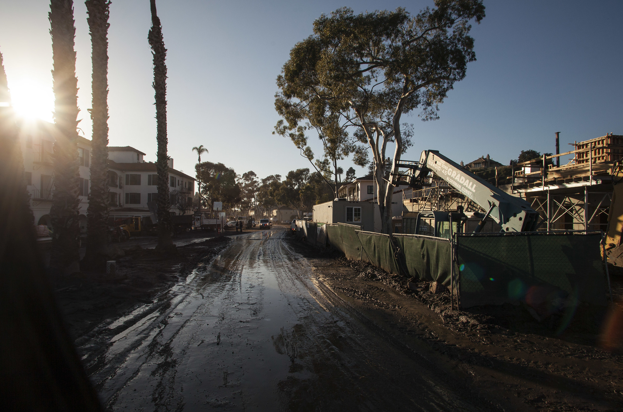
Nearly two weeks after a rain-induced mudslide swept through Montecito, officials have confirmed over 20 deaths and 127 homes destroyed. The damages led to mandatory and voluntary evacuation for thousands, as well as the closure of Highway 101. Caltrans plans to reopen the highway soon, but there is no estimate for when displaced residents will be able to “repopulate” Montecito.
With the shock and devastation of last week’s mudslides, many wonder the likelihood of the event repeating. According to University of California, Santa Barbara Earth Studies Professor Edward Kellar it’s possible, but more likely that a mudslide occurs somewhere else.
“Other areas exposed to the fire are at risk,” Kellar said in an interview with The Bottom Line. The area of a mudslide “depends on the area of the rain, but other parts are more vulnerable.” The fires are what initially primed the hills of Montecito, destroying the vegetation and loosening sediment. The following rainstorm and its unusual intensity is what caused such a severe and catastrophic event.
Though brief, the rainstorm had extreme bursts of high rain frequency in short time periods. The Santa Barbara County National Weather Service recorded that Montecito received half an inch of rain in five minutes. In all areas affected by the storm, Montecito had the highest intensity for that duration, something that hasn’t occurred for 200 years.
The rare combination of California’s largest wildfire ever overlapping with one of the most intense rainstorms of this century caused the catastrophic events in Montecito. Though these events were highly unlikely, the fire has left multiple areas at risk of mudslides if similar rain conditions occur.
Kellar said it typically takes two years for vegetation to grow back enough to establish solid roots and securely hold sediment in place. For the first two years after a fire, communities under the charred mountains in Carpinteria and Ventura are especially vulnerable.
Montecito’s safety is uncertain in the near future, as Kellar is uncertain how significant the risk is for another mudslide. “What I hope to do is go up there and find out,” Kellar said. He and a team will be researching affected areas in the upcoming week.
Larry Gurrola, Ph.D and local engineering geologist, will join Kellar in a panel discussion open to the public Thursday, Jan. 25 at 6:30 p.m. The event will be at the Falkner Gallery in the Santa Barbara Public Library. The panel hopes to share any insight they have and hopes to discuss the mudslides and wildfires overall.
Although these events are rare, Montecito has a geologic history of sediment movement. Evidence of how mudslides, landslides, and floods have contributed to the makeup of some areas are apparent, like in the sporadically placed boulders of Rocky Nook park. More recent mudslides have been observed after the 1964 Coyote and 1971 Romero fires.
Citing prior events, community officials were alert to the news of oncoming storms and preemptively evacuated some areas before the rain fell. Despite warnings and pre-storm evacuations, officials and residents had no way of predicting severity or the path of the debris flow until the event occurred.
Rainwater flooded channels and creeks in Montecito, accumulating sediment and loose debris as the rainwater rushed downstream towards houses. The mudslides increased in velocity and mass as it flowed down the mountain, cascading the lower lying homes and roads in debris.
Efforts sanctioned by the U.S. Army Corps of Engineers to remove debris have resulted in dumping a majority of the debris at Goleta Beach. Following the storm, the ocean water increased far beyond standard bacterial levels which led to temporary beach closures along the central coast.